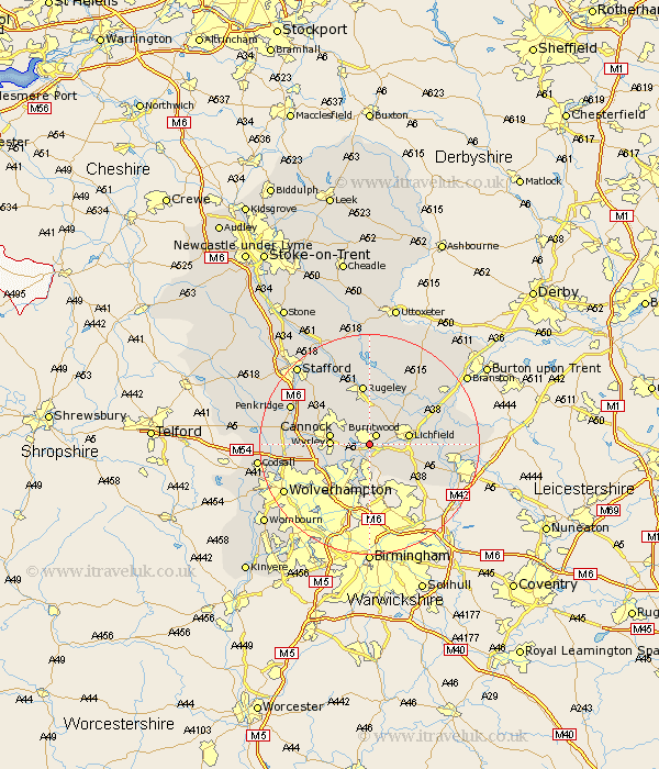
Staffordshire Map Showing Location of Chasetown
District: Lichfield
Easting: 405634 Northing: 307707
Latitude: 52.67 Longitude: -1.92
 = Chasetown
Easting: 405634 Northing: 307707
Latitude: 52.67 Longitude: -1.92
= Chasetown
This Chasetown map below is supplied by Google. Use the tools in the top left corner to zoom into street level or zoom out for a road map, you may also need to zoom in to see Chasetown on the map. Click and drag the map to move around. If the map fails to load try and refresh your browser or zoom in or out (+ or -).
Update - it seems Google no longer allow people to use their maps for free! This Chasetown map sometimes loads and sometimes gives a error. I am working on a solution.
Closest 30 Towns or Cities to Chasetown (Population over 500)
Burntwood 2.16km Hammerwich 2.92km Norton Canes 3.84km Brownhills 3.88km Longdon 6km Pelsall 6km Hednesford 6.73km Shenstone 6.74km Great Wyrley 6.75km Wyrley 6.75km Cannock 6.99km Lichfield 6.99km Aldridge 7.42km Armitage 7.74km Rushall 7.75km Huntington 8.69km Walsall 9.31km Wallsall 9.31km Whittington 10.28km Colton 11.12km Rugeley 11.18km Shareshill 11.24km Yoxall 12.9km Alrewas 13.55km Elford 13.61km Colwich 13.72km Bednall 15.02km Bilston 15.04km Penkridge 15.38km Drayton Bassett 15.4km