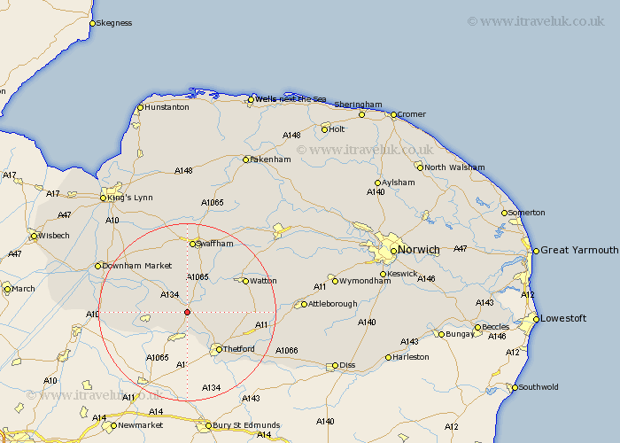
Norfolk Map Showing Location of Mundford
Population: 1591
District: Breckland
Easting: 579856 Northing: 292463
Latitude: 52.5 Longitude: 0.65
 = Mundford
District: Breckland
Easting: 579856 Northing: 292463
Latitude: 52.5 Longitude: 0.65
= Mundford
This Mundford map below is supplied by Google. Use the tools in the top left corner to zoom into street level or zoom out for a road map, you may also need to zoom in to see Mundford on the map. Click and drag the map to move around. If the map fails to load try and refresh your browser or zoom in or out (+ or -).
Update - it seems Google no longer allow people to use their maps for free! This Mundford map sometimes loads and sometimes gives a error. I am working on a solution.
Closest 30 Towns or Cities to Mundford (Population over 500)
Weeting 6km Northwold 6.51km Methwold 7.02km Feltwell 8.11km Hockwold cum Wilton 8.76km Hockwold 8.76km Thetford 11.48km Stoke Ferry 11.68km Watton 14.45km Wereham 14.59km Ashill 15.05km Griston 15.68km Hockham 15.79km Swaffham 16.72km Hilgay 17.8km Marham 18km Southery 18.14km Carbrooke 18.3km Carbooke 18.3km Rockland 18.42km Rockland Saint Peter 18.42km Rockland St. Peter 18.42km Rockland St Peter 18.42km Necton 18.96km Harling 19.31km Great Palgrave 19.37km Palgrave 19.37km Shouldham 20.13km East Harling 20.58km Narborough 20.87km