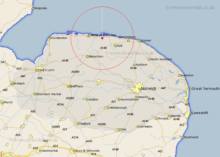
Norfolk Map Showing Location of Morston
Population: 86
District: North Norfolk
Easting: 599280 Northing: 343333
Latitude: 52.95 Longitude: 0.97
 = Morston
District: North Norfolk
Easting: 599280 Northing: 343333
Latitude: 52.95 Longitude: 0.97
= Morston
This Morston map below is supplied by Google. Use the tools in the top left corner to zoom into street level or zoom out for a road map, you may also need to zoom in to see Morston on the map. Click and drag the map to move around. If the map fails to load try and refresh your browser or zoom in or out (+ or -).
Update - it seems Google no longer allow people to use their maps for free! This Morston map sometimes loads and sometimes gives a error. I am working on a solution.
Closest 30 Towns or Cities to Morston (Population over 500)
Blakeney 2.9km Wells 8.03km Wells-on-Sea 8.03km Wells-next-the-Sea 8.03km Wells next the Sea 8.03km Wells on Sea 8.03km Little Walsingham 9.29km Walsingham 9.29km Holt 9.6km Mellon Constable 11.98km Melton Constable 11.98km Little Snoring 11.98km Weybourne 12.42km Briston 12.99km Sculthorpe 15km Ryburgh 15.2km Great Ryburgh 15.2km Hindolveston 15.2km South Creake 15.32km Burnham Market 15.63km Sheringham 15.75km Fakenham 15.76km Colkirk 18.43km Corpusty 18.57km Foulham 18.84km Foulsham 18.84km West Runton 19.08km Runton 19.08km Syderstone 20.12km Tattersett 20.33km