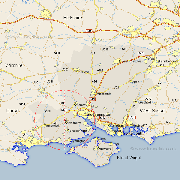
Hampshire Map Showing Location of Minstead
Population: 637
District: New Forest
Easting: 428135 Northing: 109450
Latitude: 50.88 Longitude: -1.6
 = Minstead
District: New Forest
Easting: 428135 Northing: 109450
Latitude: 50.88 Longitude: -1.6
= Minstead
This Minstead map below is supplied by Google. Use the tools in the top left corner to zoom into street level or zoom out for a road map, you may also need to zoom in to see Minstead on the map. Click and drag the map to move around. If the map fails to load try and refresh your browser or zoom in or out (+ or -).
Update - it seems Google no longer allow people to use their maps for free! This Minstead map sometimes loads and sometimes gives a error. I am working on a solution.
Closest 30 Towns or Cities to Minstead (Population over 500)
Lyndhurst 2.19km Cadnam 3.89km Bramshaw 5.68km Brockenhurst 7.77km Eling 8.39km Totton 8.98km West Wellow 9.35km Burley 10.2km Sway 11.12km Sherfield English 11.18km Marchwood 11.69km Dibden 11.84km Hale 11.93km Ibsley 12.86km Bewley 12.87km Beaulieu 12.87km Romsey 13.14km Ringwood 13.39km Boldre 13.79km Hythe 14.15km Bransgore 14.54km Southampton 14.61km Hordle 14.82km Chilworth 14.84km Fordingbridge 15.09km Sandleheath 15.2km Lymington 15.23km Itchen 15.31km Milton 17.05km New Milton 17.05km