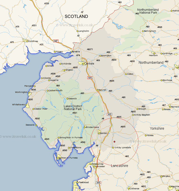
Cumbria Map Showing Location of Middleton
Population: 109
District: South Lakeland
Easting: 363081 Northing: 483979
Latitude: 54.25 Longitude: -2.57
 = Middleton
District: South Lakeland
Easting: 363081 Northing: 483979
Latitude: 54.25 Longitude: -2.57
= Middleton
This Middleton map below is supplied by Google. Use the tools in the top left corner to zoom into street level or zoom out for a road map, you may also need to zoom in to see Middleton on the map. Click and drag the map to move around. If the map fails to load try and refresh your browser or zoom in or out (+ or -).
Update - it seems Google no longer allow people to use their maps for free! This Middleton map sometimes loads and sometimes gives a error. I am working on a solution.
Closest 30 Towns or Cities to Middleton (Population over 500)
Kirkby Londsdale 5.66km Kirkby Lonsdale 5.66km Dent 7.8km Milnthorpe 8.1km Sedbergh 8.1km Millthrop 8.1km Natland 11.44km Holme 12.25km Heversham 13.13km Milnthorpe 13.52km Kendal 14.02km Kendall 14.02km Levens 14.08km Beetham 14.14km Tebay 18.57km Arnside 18.86km Staveley 20.77km Ravenstonedale 20.93km Orton 24.09km Windermere 26.15km Lower Holker 27.04km Holker 27.04km Kirkby Stephen 27.89km Haverthwaite 29.3km Crosby Ravensworth 29.67km Shap 30.35km Hawkshead 30.96km Colton 31.45km Ambleside 31.88km Brough 34.32km