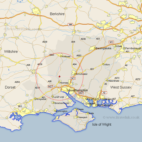
Hampshire Map Showing Location of Michelmersh
Population: 735
District: Test Valley
Easting: 435056 Northing: 126171
Latitude: 51.03 Longitude: -1.5
 = Michelmersh
District: Test Valley
Easting: 435056 Northing: 126171
Latitude: 51.03 Longitude: -1.5
= Michelmersh
This Michelmersh map below is supplied by Google. Use the tools in the top left corner to zoom into street level or zoom out for a road map, you may also need to zoom in to see Michelmersh on the map. Click and drag the map to move around. If the map fails to load try and refresh your browser or zoom in or out (+ or -).
Update - it seems Google no longer allow people to use their maps for free! This Michelmersh map sometimes loads and sometimes gives a error. I am working on a solution.
Closest 30 Towns or Cities to Michelmersh (Population over 500)
Michlemersh 0km Michelmersh 0km Kings Somborne 3.89km Romsey 5.56km Broughton 6.57km Hursley 7.23km Stockbridge 7.51km Sherfield English 8.06km Sparsholt 8.96km West Wellow 9.43km Nether Wallop 10.38km Chilworth 10.95km Otterbourne 11.13km Compton 11.8km Eastleigh 12.85km Twyford 12.95km Totton 13.02km Winchester 13.08km Over Wallop 13.13km Chilbolton 13.79km Bramshaw 13.8km Bishopstoke 13.82km Cadnam 14.22km Southampton 14.41km Eling 14.87km Goodworth Clatford 14.88km Lower Clatford 14.88km Clatford 14.88km Kings Worthy 15.04km Abbots Ann 16.72km