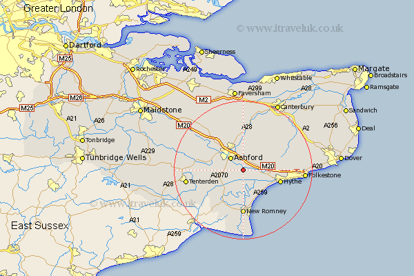
Kent Map Showing Location of Mersham
Population: 1022
District: Ashford
Easting: 605349 Northing: 137562
Latitude: 51.1 Longitude: 0.93
 = Mersham
District: Ashford
Easting: 605349 Northing: 137562
Latitude: 51.1 Longitude: 0.93
= Mersham
This Mersham map below is supplied by Google. Use the tools in the top left corner to zoom into street level or zoom out for a road map, you may also need to zoom in to see Mersham on the map. Click and drag the map to move around. If the map fails to load try and refresh your browser or zoom in or out (+ or -).
Update - it seems Google no longer allow people to use their maps for free! This Mersham map sometimes loads and sometimes gives a error. I am working on a solution.
Closest 30 Towns or Cities to Mersham (Population over 500)
Aldington 2.19km Smeeth 2.98km Hinxhill 3.7km Sellindge 4.65km Sellinge 4.65km Ashford 5.09km Kingsnorth 5.82km Brabourne 5.95km Kennington 6.56km Rockinge 6.57km Ruckinge 6.57km Orlestone 6.9km Lympne 7.91km Ham Street 8.05km Shadoxhurst 8.15km Wye 9.26km Hothfield 9.86km Dymchurch 10.37km Lyminge 10.64km Hythe 11.11km Bethersden 11.78km Woodchurch 12.22km New Romney 12.98km Stelling 13.13km Elham 13.95km Charing 14.5km Chilham 15km High Halden 15.25km Petham 15.32km Pluckley 15.79km