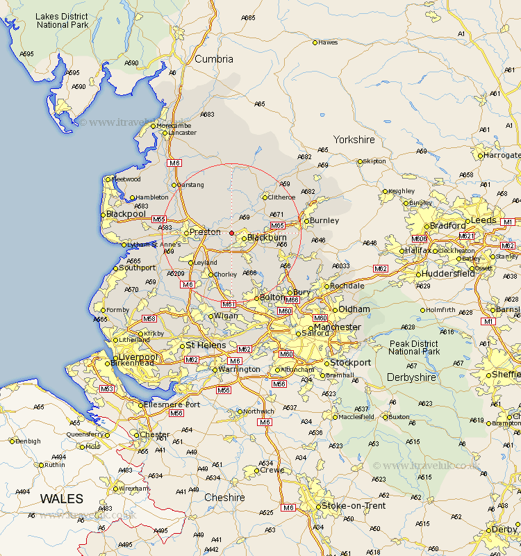
Lancashire Map Showing Location of Mellor
Population: 2131
Area Size (ha): 221
District: Ribble Valley
Easting: 364848 Northing: 430195
Latitude: 53.77 Longitude: -2.53
 = Mellor
Area Size (ha): 221
District: Ribble Valley
Easting: 364848 Northing: 430195
Latitude: 53.77 Longitude: -2.53
= Mellor
This Mellor map below is supplied by Google. Use the tools in the top left corner to zoom into street level or zoom out for a road map, you may also need to zoom in to see Mellor on the map. Click and drag the map to move around. If the map fails to load try and refresh your browser or zoom in or out (+ or -).
Update - it seems Google no longer allow people to use their maps for free! This Mellor map sometimes loads and sometimes gives a error. I am working on a solution.
Closest 30 Towns or Cities to Mellor (Population over 500)
Ribchester 3.7km Wilpshire 3.77km Blackburn 3.78km Samlesbury 5.48km Hoghton 6.46km Langho 6.61km Withnell 7.5km Grimsargh 7.54km Great Harwood 7.89km Rishton 7.89km Longridge 8.1km Darwen 8.62km Whalley 9.47km Oswaldtwistle 9.52km Brinscall 9.53km Clayton le Moors 9.86km Clayton le Moor 9.86km Clayton-le-Moors 9.86km Church 10.03km Goosnargh 10.37km Accrington 12.05km Preston 12.05km Simonstone 12.19km Farington 12.29km Farrington 12.29km Heapey 12.4km Altham 13.27km Penwortham 13.28km Chipping 13.37km Chorley 14.09km