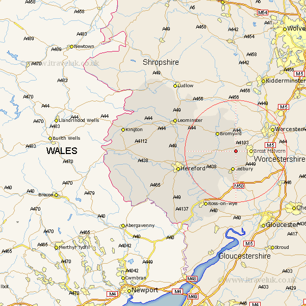
Herefordshire Map Showing Location of Mathon
Population: 278
Easting: 372613 Northing: 246607
Latitude: 52.12 Longitude: -2.4
 = Mathon
Easting: 372613 Northing: 246607
Latitude: 52.12 Longitude: -2.4
= Mathon
This Mathon map below is supplied by Google. Use the tools in the top left corner to zoom into street level or zoom out for a road map, you may also need to zoom in to see Mathon on the map. Click and drag the map to move around. If the map fails to load try and refresh your browser or zoom in or out (+ or -).
Update - it seems Google no longer allow people to use their maps for free! This Mathon map sometimes loads and sometimes gives a error. I am working on a solution.
Closest 30 Towns or Cities to Mathon (Population over 500)
Colwall 3.88km Cradley 4.27km Bosbury 5.04km Ledbury 7.5km Bromyard 10.07km Whitbourne 11.12km Much Marcle 14.67km Withington 16.04km Mordiford 17.58km Lugwardine 17.96km Fownhope 18.85km Sutton 19.44km Bodenham 19.69km Upton Bishop 20.18km Moreton 22.84km Moreton on Lugg 22.84km Moreton-on-Lugg 22.84km Hereford 22.87km Bullingham 23.55km Wellington 23.96km Weston-under-Penyard 24.04km Weston under Penyard 24.04km Weston 24.04km Ross on Wye 24.99km Ross 24.99km Ross-on-wye 24.99km Lea 25.05km Burghill 25.11km Leominster 26.17km Much Birch 27.34km