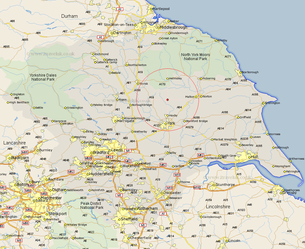
Yorkshire Map Showing Location of Marton
Population: 201
District: Ryedale
Easting: 461001 Northing: 469403
Latitude: 54.12 Longitude: -1.07
 = Marton
District: Ryedale
Easting: 461001 Northing: 469403
Latitude: 54.12 Longitude: -1.07
= Marton
This Marton map below is supplied by Google. Use the tools in the top left corner to zoom into street level or zoom out for a road map, you may also need to zoom in to see Marton on the map. Click and drag the map to move around. If the map fails to load try and refresh your browser or zoom in or out (+ or -).
Update - it seems Google no longer allow people to use their maps for free! This Marton map sometimes loads and sometimes gives a error. I am working on a solution.
Closest 30 Towns or Cities to Marton (Population over 500)
Stillington 3.75km Huby 5.72km Sheriff Hutton 5.72km Terrington 6.52km Strensall 7.73km Easingwold 8.69km Ampleforth 9.82km Slingsby 10.45km Shipton 10.75km Haxby 11.12km Wigginton 11.12km Tollerton 11.25km Alne 11.48km Raskelf 12.09km Earswick 13.02km Huntington 13.02km Newton 13.48km Newton upon Ouse 13.48km Skelton 13.69km Nawton 14.05km Helmsley 14.82km New Earswick 14.83km Linton 15.13km Linton upon Ouse 15.13km Linton-on-Ouse 15.13km Linton on Ouse 15.13km York 16.71km Clifton 16.82km Malton 16.83km Poppleton 17.54km