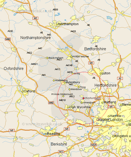
Buckinghamshire Map Showing Location of Chesham
Population: 19718
Area Size (ha): 506
District: Chiltern
Easting: 496740 Northing: 201118
Latitude: 51.7 Longitude: -0.6
 = Chesham
Area Size (ha): 506
District: Chiltern
Easting: 496740 Northing: 201118
Latitude: 51.7 Longitude: -0.6
= Chesham
This Chesham map below is supplied by Google. Use the tools in the top left corner to zoom into street level or zoom out for a road map, you may also need to zoom in to see Chesham on the map. Click and drag the map to move around. If the map fails to load try and refresh your browser or zoom in or out (+ or -).
Update - it seems Google no longer allow people to use their maps for free! This Chesham map sometimes loads and sometimes gives a error. I am working on a solution.
Closest 30 Towns or Cities to Chesham (Population over 500)
Amersham 3.88km Latimer 3.92km Little Missenden 5.9km Lee 6.04km Great Missenden 6.89km Hazlemere 8.86km Prestwood 9.19km Chalfont St Giles 9.54km Chalfont Saint Giles 9.54km Chalfont St. Giles 9.54km Hughenden 10.75km Penn 10.9km Beaconsfield 11.35km Gerrards Cross 11.58km Chalfont St Peter 11.64km Chalfont Saint Peter 11.64km Chalfont St. Peter 11.64km Wendover 12.71km Pitstone 13.03km Halton 13.04km Flackwell Heath 13.09km High Wycombe 13.68km Chepping 13.68km Wycombe 13.68km Buckland 13.72km Aston Clinton 13.72km Marsworth 13.76km Ellesborough 13.8km Weston Turville 13.87km Kimble 14.27km