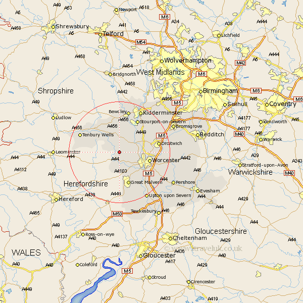
Worcestershire Map Showing Location of Martley
Population: 1171
District: Malvern Hills
Easting: 374961 Northing: 259563
Latitude: 52.23 Longitude: -2.37
 = Martley
District: Malvern Hills
Easting: 374961 Northing: 259563
Latitude: 52.23 Longitude: -2.37
= Martley
This Martley map below is supplied by Google. Use the tools in the top left corner to zoom into street level or zoom out for a road map, you may also need to zoom in to see Martley on the map. Click and drag the map to move around. If the map fails to load try and refresh your browser or zoom in or out (+ or -).
Update - it seems Google no longer allow people to use their maps for free! This Martley map sometimes loads and sometimes gives a error. I am working on a solution.
Closest 30 Towns or Cities to Martley (Population over 500)
Clifton 3.88km Clifton upon Teme 3.88km Great Witley 5.67km Leigh 6.52km Abberley 7.42km Grimley 7.95km Suckley 8.15km Holt 8.16km Hallow 8.16km Astley 8.16km Ombersley 9.81km Powick 10.87km Rock 11.35km Fernhill Heath 11.35km Lindridge 11.5km Worcester 11.94km Malvern 13.41km Great Malvern 13.41km Hartlebury 14.35km Stourport-on-Severn 14.65km Stourport 14.65km Stourport on Severn 14.65km Droitwich 15.21km Kempsey 15.9km Tenbury Wells 16.5km Tenbury 16.5km Malvern Wells 16.83km Bewdley 17.02km Crowle 17.43km Seven Stoke 18.01km