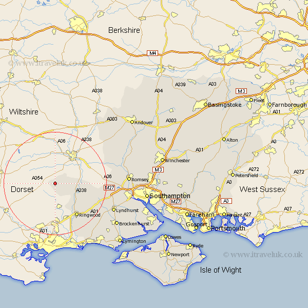
Hampshire Map Showing Location of Martin
Population: 398
District: New Forest
Easting: 407021 Northing: 118652
Latitude: 50.97 Longitude: -1.9
 = Martin
District: New Forest
Easting: 407021 Northing: 118652
Latitude: 50.97 Longitude: -1.9
= Martin
This Martin map below is supplied by Google. Use the tools in the top left corner to zoom into street level or zoom out for a road map, you may also need to zoom in to see Martin on the map. Click and drag the map to move around. If the map fails to load try and refresh your browser or zoom in or out (+ or -).
Update - it seems Google no longer allow people to use their maps for free! This Martin map sometimes loads and sometimes gives a error. I am working on a solution.
Closest 30 Towns or Cities to Martin (Population over 500)
Damerham 5.1km South Damerham 5.1km Fordingbridge 7.93km Sandleheath 10.96km Hale 11.82km Ibsley 12.36km Ringwood 15.34km Bramshaw 20.19km Burley 21.79km West Wellow 22.18km Sherfield English 22.25km Cadnam 22.87km Minstead 22.98km Bransgore 23.51km Sopley 23.7km Lyndhurst 24.83km Broughton 27.7km Over Wallop 27.98km Romsey 28.07km Nether Wallop 28.66km Brockenhurst 28.72km Michelmersh 28.95km Michlemersh 28.95km Sway 29.31km Totton 29.72km Eling 30.13km Kings Somborne 31.19km Milton 31.33km New Milton 31.33km Hordle 32km