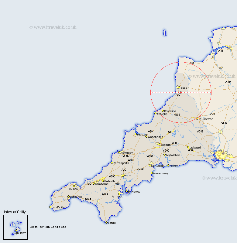
Cornwall Map Showing Location of Marhamchurch
Population: 754
District: North Cornwall
Easting: 222676 Northing: 103130
Latitude: 50.8 Longitude: -4.52
 = Marhamchurch
District: North Cornwall
Easting: 222676 Northing: 103130
Latitude: 50.8 Longitude: -4.52
= Marhamchurch
This Marhamchurch map below is supplied by Google. Use the tools in the top left corner to zoom into street level or zoom out for a road map, you may also need to zoom in to see Marhamchurch on the map. Click and drag the map to move around. If the map fails to load try and refresh your browser or zoom in or out (+ or -).
Update - it seems Google no longer allow people to use their maps for free! This Marhamchurch map sometimes loads and sometimes gives a error. I am working on a solution.
Closest 30 Towns or Cities to Marhamchurch (Population over 500)
Bude 3.88km Pounstock 4.38km Poundstock 4.38km Kilkhampton 9.55km Morwenstow 11.36km Moorwinstow 11.36km North Petherwin 14.24km Forrabury 19.14km Launceston 21.33km Tintagel 22.12km Altarnun 22.27km South Petherwin 22.44km Lewannick 23km Camelford 23.52km Lezant 26.8km North Hill 28.41km Linkinhorne 31.48km Blisland 33.62km Cardinham 36.45km Cardingham 36.45km Callington 36.69km Wadebridge 38.61km Dobwalls 38.92km Liskeard 39.2km Bodmin 39.65km Menheniot 41.38km Bere Alston 41.7km Calstock 41.7km Padstow 41.74km Lanivet 42.73km