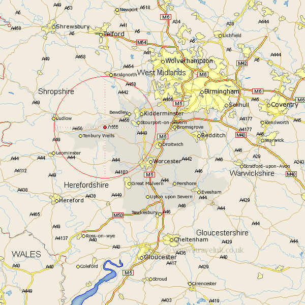
Worcestershire Map Showing Location of Mamble
Population: 308
District: Malvern Hills
Easting: 369340 Northing: 270717
Latitude: 52.33 Longitude: -2.45
 = Mamble
District: Malvern Hills
Easting: 369340 Northing: 270717
Latitude: 52.33 Longitude: -2.45
= Mamble
This Mamble map below is supplied by Google. Use the tools in the top left corner to zoom into street level or zoom out for a road map, you may also need to zoom in to see Mamble on the map. Click and drag the map to move around. If the map fails to load try and refresh your browser or zoom in or out (+ or -).
Update - it seems Google no longer allow people to use their maps for free! This Mamble map sometimes loads and sometimes gives a error. I am working on a solution.
Closest 30 Towns or Cities to Mamble (Population over 500)
Lindridge 2.17km Rock 3.4km Abberley 6.77km Great Witley 8.78km Clifton upon Teme 9.54km Clifton 9.54km Astley 9.79km Tenbury Wells 9.79km Tenbury 9.79km Bewdley 10.62km Martley 12.48km Stourport on Severn 12.59km Stourport 12.59km Stourport-on-Severn 12.59km Arley 13.03km Upper Arley 13.03km Kidderminster 14.67km Hartlebury 14.72km Holt 16.46km Ombersley 16.49km Stone 17.38km Grimley 17.57km Suckley 18.66km Hallow 18.8km Leigh 18.99km Chaddesley Corbett 19.34km Fernhill Heath 20.32km Churchill 20.34km Droitwich 21.7km Worcester 22.56km