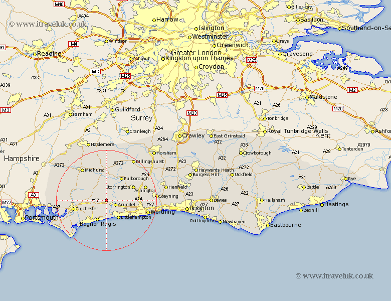
Sussex Map Showing Location of Madehurst
Population: 105
District: Arun
Easting: 498507 Northing: 108461
Latitude: 50.87 Longitude: -0.6
 = Madehurst
District: Arun
Easting: 498507 Northing: 108461
Latitude: 50.87 Longitude: -0.6
= Madehurst
This Madehurst map below is supplied by Google. Use the tools in the top left corner to zoom into street level or zoom out for a road map, you may also need to zoom in to see Madehurst on the map. Click and drag the map to move around. If the map fails to load try and refresh your browser or zoom in or out (+ or -).
Update - it seems Google no longer allow people to use their maps for free! This Madehurst map sometimes loads and sometimes gives a error. I am working on a solution.
Closest 30 Towns or Cities to Madehurst (Population over 500)
Walberton 2.19km Slindon 2.99km Arundel 3.97km Bury 4.38km Eastergate 5.11km Ford 5.68km Westergate 6.01km Barnham 6.03km Amberley 7.26km Yapton 7.42km Tangmere 8.4km Boxgrove 8.4km Coldwaltham 8.76km Littlehampton 8.77km Bognor Regis 8.89km Oving 8.99km Middleton on Sea 9.35km Middleton-on-Sea 9.35km Middleton 9.35km Graffham 9.43km Fittleworth 9.55km Angmering 9.9km Felpham 9.92km Bognor 9.92km Rustington 10.21km Pulborough 10.95km Bersted 10.97km Storrington 11.97km West Chillington 12.86km West Chiltington 12.86km