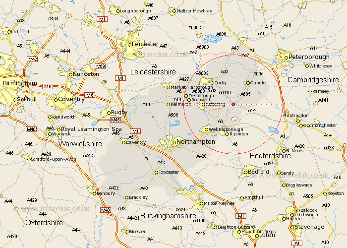
Northamptonshire Map Showing Location of Lowick
Population: 272
District: East Northamptonshire
Easting: 498641 Northing: 279029
Latitude: 52.4 Longitude: -0.55
 = Lowick
District: East Northamptonshire
Easting: 498641 Northing: 279029
Latitude: 52.4 Longitude: -0.55
= Lowick
This Lowick map below is supplied by Google. Use the tools in the top left corner to zoom into street level or zoom out for a road map, you may also need to zoom in to see Lowick on the map. Click and drag the map to move around. If the map fails to load try and refresh your browser or zoom in or out (+ or -).
Update - it seems Google no longer allow people to use their maps for free! This Lowick map sometimes loads and sometimes gives a error. I am working on a solution.
Closest 30 Towns or Cities to Lowick (Population over 500)
Thrapston 1.13km Islip 2.17km Woodford 3.88km Titchmarsh 4.52km Ringstead 5.56km Brigstock 6.51km Raunds 7.5km Stanwick 9.26km Finedon 9.33km Burton Latimer 9.68km Geddington 9.77km Irthlingborough 9.87km Stanion 10.05km Oundle 10.85km Weldon 10.85km Kettering 11.31km Higham Ferrers 11.35km Isham 11.6km Corby 12.18km Rushden 13.17km Warmington 15.07km Wellingborough 15.08km Broughton 15.16km Irchester 15.87km Cottingham 16.42km Gretton 16.8km Rothwell 17.06km Rowell 17.06km Caldecott 17.2km Great Doddington 17.99km