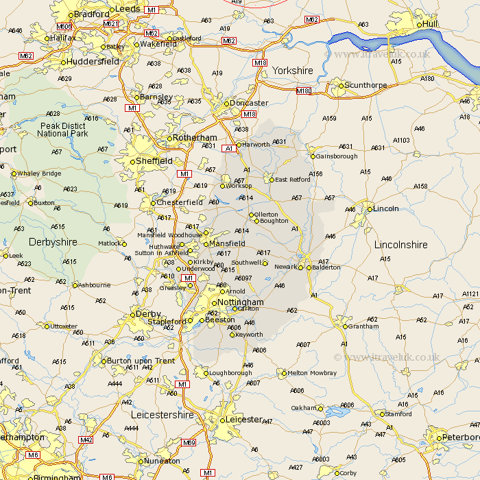
Nottinghamshire Map Showing Location of Lowdham
Population: 2171
Area Size (ha): 67
District: Newark and Sherwood
Easting: 467102 Northing: 345244
Latitude: 54 Longitude: -1
 = Lowdham
Area Size (ha): 67
District: Newark and Sherwood
Easting: 467102 Northing: 345244
Latitude: 54 Longitude: -1
= Lowdham
This Lowdham map below is supplied by Google. Use the tools in the top left corner to zoom into street level or zoom out for a road map, you may also need to zoom in to see Lowdham on the map. Click and drag the map to move around. If the map fails to load try and refresh your browser or zoom in or out (+ or -).
Update - it seems Google no longer allow people to use their maps for free! This Lowdham map sometimes loads and sometimes gives a error. I am working on a solution.
Closest 30 Towns or Cities to Lowdham (Population over 500)
Nunthorpe 58.46km Stainton 59.7km Misson 61.2km Misterton 61.95km Bircotes 64.94km Harworth 65.01km Walkeringham 65.78km Mattersey 66.75km Everton 66.8km Styrrup 66.94km Gringley on the Hill 67.04km Gringley-on-the-Hill 67.04km Gringley 67.04km Beckingham 67.61km Ramskill 70.43km Ranskill 70.43km Blyth 70.56km Sutton 72.29km Clarborough 72.58km Hayton 72.58km East Retford 76.11km Shireoaks 76.77km North Leverton 76.93km Grove 78.12km Worksop 78.33km Bampton 78.94km Rampton 78.94km Elkesley 81.57km Elksley 81.57km East Markham 83.75km