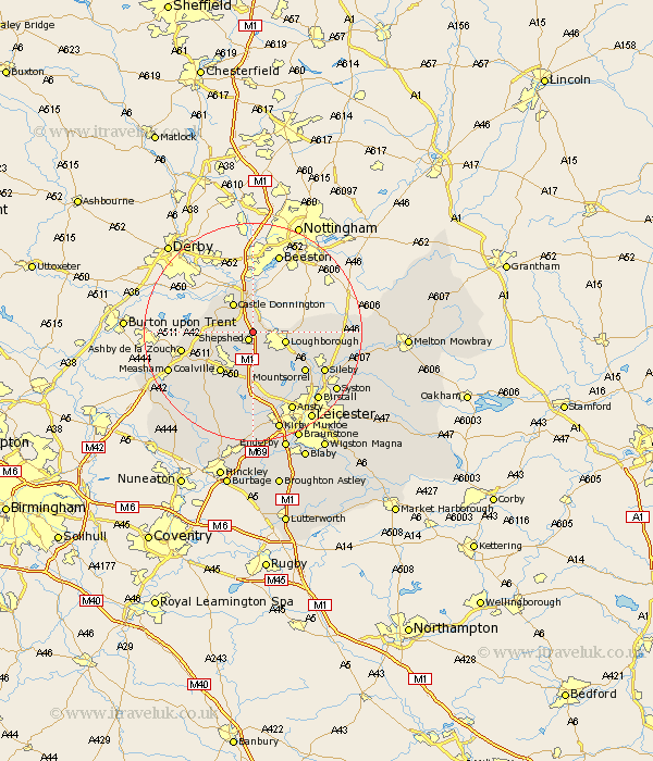
Leicestershire Map Showing Location of Long Whatton
District: North West Leicestershire
Easting: 448331 Northing: 320913
Latitude: 52.78 Longitude: -1.28
 = Long Whatton
Easting: 448331 Northing: 320913
Latitude: 52.78 Longitude: -1.28
= Long Whatton
This Long Whatton map below is supplied by Google. Use the tools in the top left corner to zoom into street level or zoom out for a road map, you may also need to zoom in to see Long Whatton on the map. Click and drag the map to move around. If the map fails to load try and refresh your browser or zoom in or out (+ or -).
Update - it seems Google no longer allow people to use their maps for free! This Long Whatton map sometimes loads and sometimes gives a error. I am working on a solution.
Closest 30 Towns or Cities to Long Whatton (Population over 500)
Sheepshed 1.62km Shepshed 1.62km Hathern 2.24km Belton 3.84km Diseworth 3.84km Kegworth 3.88km Loughborough 5.9km Castle Donington 6.5km Castle Donnington 6.5km Swannington 7.14km Breedon on the Hill 7.85km Breedon-on-the-Hill 7.85km Breedon 7.85km Worthington 8.06km Coleorton 8.68km Woodhouse 9.29km Coalville 9.29km Quorndon 9.62km Barrow upon Soar 10.55km Barrow 10.55km Burton-on-the-Wolds 11.36km Burton 11.36km Burton on the Wolds 11.36km Mountsorrel 11.64km Ravenstone with Snibston 12.14km Ravenstone 12.14km Wimeswould 12.33km Wymeswold 12.33km Ashby de la Zouch 12.88km Markfield 12.97km