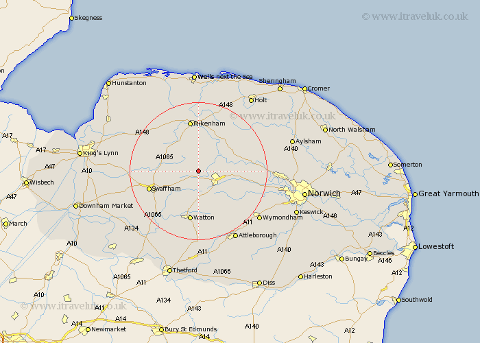
Norfolk Map Showing Location of Longham
Population: 219
District: Breckland
Easting: 593673 Northing: 315263
Latitude: 52.7 Longitude: 0.87
 = Longham
District: Breckland
Easting: 593673 Northing: 315263
Latitude: 52.7 Longitude: 0.87
= Longham
This Longham map below is supplied by Google. Use the tools in the top left corner to zoom into street level or zoom out for a road map, you may also need to zoom in to see Longham on the map. Click and drag the map to move around. If the map fails to load try and refresh your browser or zoom in or out (+ or -).
Update - it seems Google no longer allow people to use their maps for free! This Longham map sometimes loads and sometimes gives a error. I am working on a solution.
Closest 30 Towns or Cities to Longham (Population over 500)
Beetley 3.85km Mileham 3.87km Litcham 4.86km Dereham 4.86km East Dereham 4.86km North Elmham 6.72km Necton 7.9km Yaxham 8.74km Shipdham 9.53km Palgrave 9.72km Great Palgrave 9.72km Colkirk 11.18km Bawdeswell 11.82km Ashill 11.99km Castle Acre 12.35km Mattishall 12.54km Carbrooke 13.03km Carbooke 13.03km Ryburgh 13.41km Great Ryburgh 13.41km Lyng 13.6km Foulsham 13.7km Foulham 13.7km Hockering 13.98km Swaffham 14.58km Fakenham 14.99km Watton 14.99km Hingham 15.18km Great Massingham 15.37km Massingham 15.37km