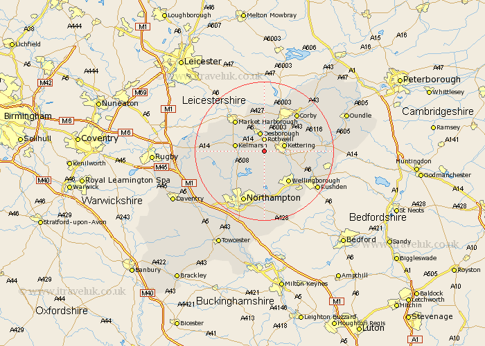
Northamptonshire Map Showing Location of Loddington
Population: 477
District: Kettering
Easting: 481665 Northing: 276860
Latitude: 52.38 Longitude: -0.8
 = Loddington
District: Kettering
Easting: 481665 Northing: 276860
Latitude: 52.38 Longitude: -0.8
= Loddington
This Loddington map below is supplied by Google. Use the tools in the top left corner to zoom into street level or zoom out for a road map, you may also need to zoom in to see Loddington on the map. Click and drag the map to move around. If the map fails to load try and refresh your browser or zoom in or out (+ or -).
Update - it seems Google no longer allow people to use their maps for free! This Loddington map sometimes loads and sometimes gives a error. I am working on a solution.
Closest 30 Towns or Cities to Loddington (Population over 500)
Broughton 2.92km Rowell 3.71km Rothwell 3.71km Walgrave 5.67km Desborough 5.67km Kettering 5.95km Isham 7.73km Geddington 9.67km Burton Latimer 9.78km Brixworth 10.05km Clipston 10.83km Pitsford 10.86km Wilbarston 11.12km Sywell 11.18km Overstone 11.18km Wellingborough 11.49km Cottingham 11.63km Moulton 11.63km Naseby 12.44km Spratton 12.6km Finedon 12.61km Boughton 13.03km Stanion 13.76km Wilby 14.15km Corby 14.33km Great Doddington 14.64km Doddington 14.64km Guilsborough 14.68km Billing 14.86km Great Billing 14.86km