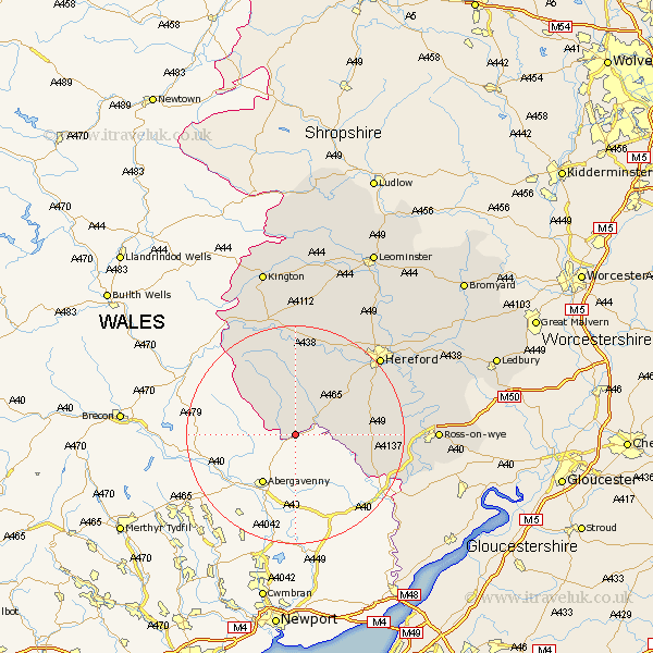
Herefordshire Map Showing Location of Llancillo
Population: 38
Easting: 335814 Northing: 224701
Latitude: 51.92 Longitude: -2.93
 = Llancillo
Easting: 335814 Northing: 224701
Latitude: 51.92 Longitude: -2.93
= Llancillo
This Llancillo map below is supplied by Google. Use the tools in the top left corner to zoom into street level or zoom out for a road map, you may also need to zoom in to see Llancillo on the map. Click and drag the map to move around. If the map fails to load try and refresh your browser or zoom in or out (+ or -).
Update - it seems Google no longer allow people to use their maps for free! This Llancillo map sometimes loads and sometimes gives a error. I am working on a solution.
Closest 30 Towns or Cities to Llancillo (Population over 500)
Ewyas Harold 5.05km Peterchurch 13.02km Kingstone 13.06km Broad Oak 13.11km Madley 14.17km Much Dewchurch 14.58km Allensmore 15.14km Much Birch 15.86km Bullingham 19.71km Whitchurch 20.81km Hereford 20.97km Credenhill 22.33km Goodrich 22.43km Walford 23.17km Clifford 23.36km Burghill 23.36km Eardisley 24.51km Moreton-on-Lugg 24.55km Moreton on Lugg 24.55km Moreton 24.55km Fownhope 24.65km Ross on Wye 25.15km Ross-on-wye 25.15km Ross 25.15km Mordiford 25.33km Lugwardine 25.58km Almeley 26.17km Sutton 26.61km Wellington 27.15km Weston under Penyard 27.43km