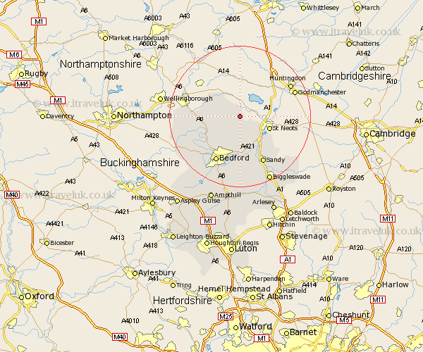
Bedfordshire Map Showing Location of Little Staughton
Population: 421
District: Bedford
Easting: 510351 Northing: 262588
Latitude: 52.25 Longitude: -0.38
 = Little Staughton
District: Bedford
Easting: 510351 Northing: 262588
Latitude: 52.25 Longitude: -0.38
= Little Staughton
This Little Staughton map below is supplied by Google. Use the tools in the top left corner to zoom into street level or zoom out for a road map, you may also need to zoom in to see Little Staughton on the map. Click and drag the map to move around. If the map fails to load try and refresh your browser or zoom in or out (+ or -).
Update - it seems Google no longer allow people to use their maps for free! This Little Staughton map sometimes loads and sometimes gives a error. I am working on a solution.
Closest 30 Towns or Cities to Little Staughton (Population over 500)
Bolnhurst 3.87km Riseley 5.67km Thurleigh 7.18km Roxton 10.86km Sharnbrook 10.87km Great Barford 11.35km Milton Ernest 11.73km Tempsford 12.49km Oakley 12.97km Willington 13.03km Clapham 13.04km Pavenham 13.56km Blunham 13.75km Bromham 14.36km Bedford 14.55km Stevington 14.65km Sandy 14.72km Cople 14.82km Wymington 14.86km Biddenham 15.22km Carlton 16.52km Harrold 16.52km Everton 16.52km Northill 17.29km Elstow 17.62km Kempston 18.02km Potton 19.39km Turvey 19.39km Biggleswade 20.17km Wootton 20.65km