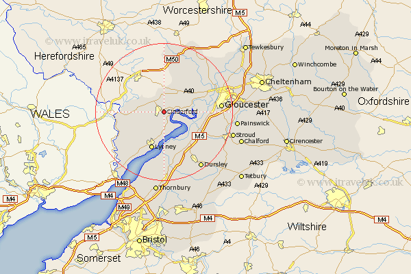
Gloucestershire Map Showing Location of Cinderford
Population: 9387
Area Size (ha): 270
District: Forest of Dean
Easting: 366686 Northing: 213275
Latitude: 51.82 Longitude: -2.48
 = Cinderford
Area Size (ha): 270
District: Forest of Dean
Easting: 366686 Northing: 213275
Latitude: 51.82 Longitude: -2.48
= Cinderford
This Cinderford map below is supplied by Google. Use the tools in the top left corner to zoom into street level or zoom out for a road map, you may also need to zoom in to see Cinderford on the map. Click and drag the map to move around. If the map fails to load try and refresh your browser or zoom in or out (+ or -).
Update - it seems Google no longer allow people to use their maps for free! This Cinderford map sometimes loads and sometimes gives a error. I am working on a solution.
Closest 30 Towns or Cities to Cinderford (Population over 500)
Drybrook 3.88km Newham 3.91km Newnham 3.91km Mitcheldean 5.56km Milcheldean 5.56km Longhope 6.02km Awre 6.53km Lydbrook 7.81km Huntley 7.98km Coleford 8.23km Bream 9.37km Frampton on Severn 9.76km Frampton-on-Severn 9.76km Frampton 9.76km Staunton 11.46km Lydney 11.64km Newland 12.05km Hardwicke 12.6km Tibberton 13.03km Slimbridge 13.07km Quedgeley 13.75km Newent 14.17km Berkeley 15.01km Coaley 15.17km Woolaston 15.26km Stonehouse 15.63km Cam 15.89km Gloucester 16.14km Saint Briavels 16.59km St. Briavels 16.59km