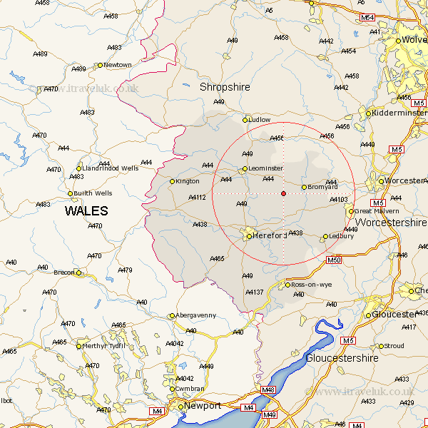
Herefordshire Map Showing Location of Little Cowarne
Population: 104
Easting: 360107 Northing: 252253
Latitude: 52.17 Longitude: -2.58
 = Little Cowarne
Easting: 360107 Northing: 252253
Latitude: 52.17 Longitude: -2.58
= Little Cowarne
This Little Cowarne map below is supplied by Google. Use the tools in the top left corner to zoom into street level or zoom out for a road map, you may also need to zoom in to see Little Cowarne on the map. Click and drag the map to move around. If the map fails to load try and refresh your browser or zoom in or out (+ or -).
Update - it seems Google no longer allow people to use their maps for free! This Little Cowarne map sometimes loads and sometimes gives a error. I am working on a solution.
Closest 30 Towns or Cities to Little Cowarne (Population over 500)
Bromyard 5.97km Bodenham 7.07km Withington 8.16km Sutton 10.08km Wellington 11.96km Lugwardine 12.01km Leominster 12.62km Moreton 12.64km Moreton on Lugg 12.64km Moreton-on-Lugg 12.64km Bosbury 12.99km Mordiford 13.42km Whitbourne 13.68km Burghill 14.55km Hereford 15.85km Luston 15.89km Colwall 16.5km Credenhill 16.55km Brimfield 16.82km Ledbury 17.26km Bullingham 17.41km Kingsland 17.43km Cradley 17.87km Fownhope 18.57km Orleton 18.67km Eardisland 19.01km Weobley 19.32km Much Marcle 19.39km Dilwyn 19.41km Croft 19.64km