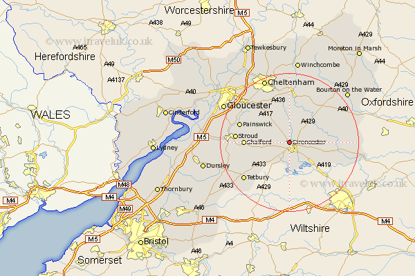
Gloucestershire Map Showing Location of Cirencester
Population: 15286
Area Size (ha): 352
District: Cotswold
Easting: 401151 Northing: 203893
Latitude: 51.73 Longitude: -1.98
 = Cirencester
Area Size (ha): 352
District: Cotswold
Easting: 401151 Northing: 203893
Latitude: 51.73 Longitude: -1.98
= Cirencester
This Cirencester map below is supplied by Google. Use the tools in the top left corner to zoom into street level or zoom out for a road map, you may also need to zoom in to see Cirencester on the map. Click and drag the map to move around. If the map fails to load try and refresh your browser or zoom in or out (+ or -).
Update - it seems Google no longer allow people to use their maps for free! This Cirencester map sometimes loads and sometimes gives a error. I am working on a solution.
Closest 30 Towns or Cities to Cirencester (Population over 500)
North Cerney 3.89km Siddington 6.02km Ampney St Peter 7.82km Ampney 7.82km Ampney St. Peter 7.82km Ampney Saint Peter 7.82km Cerney 8.71km South Cerney 8.71km Chedworth 8.72km Withington 11.35km Bibury 11.62km Chalford 12.63km Minchinhampton 13.16km Avening 13.8km Quenington 13.9km Fairford 14.27km Painswick 14.85km Andoversford 15.01km Stroud 15.03km Charlton Kings 15.9km Nailsworth 15.93km Northleach 15.97km Leckhampton 16.35km Kempsford 16.67km Tetbury 16.83km Woodchester 17.32km Shurdington 17.44km Brockworth 18.09km Horsley 18.1km Randwick 18.73km