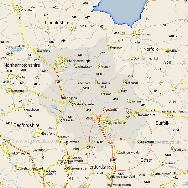
Cambridgeshire Map Showing Location of Linton
Population: 3859
Area Size (ha): 127
District: South Cambridgeshire
Easting: 555236 Northing: 247098
Latitude: 52.1 Longitude: 0.27
 = Linton
Area Size (ha): 127
District: South Cambridgeshire
Easting: 555236 Northing: 247098
Latitude: 52.1 Longitude: 0.27
= Linton
This Linton map below is supplied by Google. Use the tools in the top left corner to zoom into street level or zoom out for a road map, you may also need to zoom in to see Linton on the map. Click and drag the map to move around. If the map fails to load try and refresh your browser or zoom in or out (+ or -).
Update - it seems Google no longer allow people to use their maps for free! This Linton map sometimes loads and sometimes gives a error. I am working on a solution.
Closest 30 Towns or Cities to Linton (Population over 500)
Balsham 5.04km Ickleton 6.79km Sawston 7.08km Whittlesford 8.18km Duxford 8.18km Castle Camps 8.81km Castle Camp 8.81km Great Wilbraham 9.33km Wilbraham 9.33km Shelford 9.83km Fulbourn 9.87km Fulbourne 9.87km Thriplow 11.39km Teversham 12.49km Fowlmere 12.66km Foulmere 12.66km Hauxton 12.66km Bottisham 12.98km Dullingham 13.05km Harston 13.05km Foxton 13.78km Stetchworth 14.37km Swaffham Bulbeck 14.87km Shepreth 14.91km Cambridge 15.11km Haslingfield 15.25km Barrington 16.04km Milton 16.82km Swaffham Prior 16.83km Needham Market 16.87km