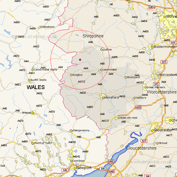
Herefordshire Map Showing Location of Lingen
Population: 164
Easting: 336362 Northing: 267328
Latitude: 52.3 Longitude: -2.93
 = Lingen
Easting: 336362 Northing: 267328
Latitude: 52.3 Longitude: -2.93
= Lingen
This Lingen map below is supplied by Google. Use the tools in the top left corner to zoom into street level or zoom out for a road map, you may also need to zoom in to see Lingen on the map. Click and drag the map to move around. If the map fails to load try and refresh your browser or zoom in or out (+ or -).
Update - it seems Google no longer allow people to use their maps for free! This Lingen map sometimes loads and sometimes gives a error. I am working on a solution.
Closest 30 Towns or Cities to Lingen (Population over 500)
Wigmore 5.96km Shobdon 7.17km Leintwardine 8.69km Croft 9.26km Pembridge 9.54km Kingsland 10.64km Eardisland 10.86km Lyonshall 11.63km Orleton 12.47km Kington 12.48km Luston 13.01km Dilwyn 13.75km Leominster 15.5km Weobley 15.5km Brimfield 15.87km Almeley 17.02km Eardisley 19.08km Wellington 22.35km Bodenham 23.84km Credenhill 24.02km Burghill 24.97km Clifford 24.97km Moreton-on-Lugg 26.08km Moreton on Lugg 26.08km Moreton 26.08km Sutton 28.02km Peterchurch 29.68km Madley 30.19km Withington 30.21km Hereford 31.48km