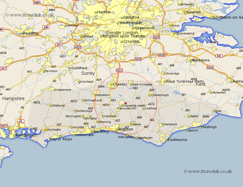
Sussex Map Showing Location of Lindfield
Population: 5394
District: Mid Sussex
Easting: 535642 Northing: 124128
Latitude: 51 Longitude: -0.07
 = Lindfield
District: Mid Sussex
Easting: 535642 Northing: 124128
Latitude: 51 Longitude: -0.07
= Lindfield
This Lindfield map below is supplied by Google. Use the tools in the top left corner to zoom into street level or zoom out for a road map, you may also need to zoom in to see Lindfield on the map. Click and drag the map to move around. If the map fails to load try and refresh your browser or zoom in or out (+ or -).
Update - it seems Google no longer allow people to use their maps for free! This Lindfield map sometimes loads and sometimes gives a error. I am working on a solution.
Closest 30 Towns or Cities to Lindfield (Population over 500)
Baywards Heath 2.98km Haywards Heath 2.98km Ardingly 3.88km Horsted Keynes 3.96km South Nutfield 5.02km Cuckfield 5.02km Wivelsfield 5.68km Burgess Hill 5.96km Balcombe 6.57km Newick 6.91km Fletching 7.24km Chailey 8.06km Turners Hill 9.34km Botney 9.51km Bolney 9.51km Ditchelling 9.55km Ditchling 9.55km Forest Row 9.55km Slaugham 10.03km Hassocks 10.37km Keymer 10.38km Maresfield 10.66km Albourne 11.03km Hurstpierpoint 11.61km Isfield 11.92km Worth 12.06km Uckfield 12.24km Lower Beeding 12.96km Plumpton 13.03km Barcombe Mills Station 13.14km