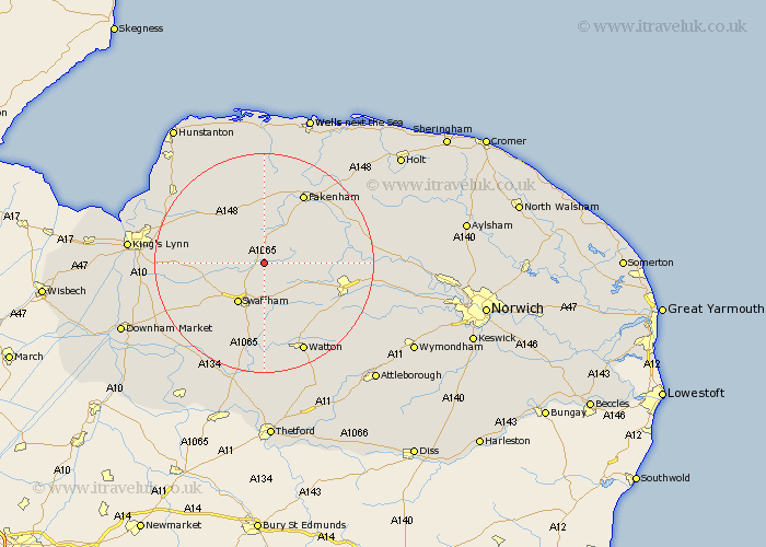
Norfolk Map Showing Location of Lexham
Population: 157
District: Breckland
Easting: 584597 Northing: 316769
Latitude: 52.72 Longitude: 0.73
 = Lexham
District: Breckland
Easting: 584597 Northing: 316769
Latitude: 52.72 Longitude: 0.73
= Lexham
This Lexham map below is supplied by Google. Use the tools in the top left corner to zoom into street level or zoom out for a road map, you may also need to zoom in to see Lexham on the map. Click and drag the map to move around. If the map fails to load try and refresh your browser or zoom in or out (+ or -).
Update - it seems Google no longer allow people to use their maps for free! This Lexham map sometimes loads and sometimes gives a error. I am working on a solution.
Closest 30 Towns or Cities to Lexham (Population over 500)
Castle Acre 3.85km Litcham 4.49km Great Palgrave 5.56km Palgrave 5.56km Great Massingham 7.15km Massingham 7.15km Mileham 8.07km Necton 8.15km Swaffham 8.67km Narborough 10.77km East Rudham 11.18km Colkirk 12.14km Beetley 12.35km Gayton 12.48km Tattersett 12.97km Tatterset 12.97km Grimston 13.54km Ashill 13.73km Dereham 13.98km East Dereham 13.98km Marham 14.41km Fakenham 14.61km North Elmham 14.71km Syderstone 14.87km Shipdham 15.81km East Winch 15.82km Sculthorpe 15.85km Bircham 16.28km Great Bircham 16.28km Great Ryburgh 16.61km