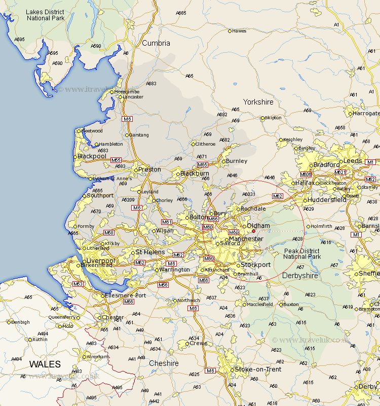
Lancashire Map Showing Location of Lees
District: Oldham
Easting: 395581 Northing: 404101
Latitude: 53.53 Longitude: -2.07
 = Lees
Easting: 395581 Northing: 404101
Latitude: 53.53 Longitude: -2.07
= Lees
This Lees map below is supplied by Google. Use the tools in the top left corner to zoom into street level or zoom out for a road map, you may also need to zoom in to see Lees on the map. Click and drag the map to move around. If the map fails to load try and refresh your browser or zoom in or out (+ or -).
Update - it seems Google no longer allow people to use their maps for free! This Lees map sometimes loads and sometimes gives a error. I am working on a solution.
Closest 30 Towns or Cities to Lees (Population over 500)
Mossley 3.79km Oldham 3.79km Shaw 3.87km Ashton-under-Lyne 4.31km Ashton under Lyne 4.31km Ashton 4.31km Failsworth 4.78km Royton 4.97km Delph 4.97km Uppermill 5.18km Milnrow 7.74km Droylesden 7.83km Droylsden 7.83km Middleton 9km Denton 9.84km Hollingworth 10.11km Chadderton 10.26km Manchester 10.59km Rochdale 10.78km Littleborough 11.33km Heywood 11.36km Wardle 13.7km Prestwich 14.32km Salford 14.35km Whitworth 15.09km Whitefield 15.53km Bury 17.1km Radcliffe 17.72km Pendlebury 17.72km Eccles 18.49km