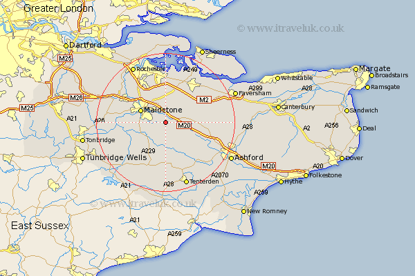
Kent Map Showing Location of Leeds
Population: 679
District: Maidstone
Easting: 582656 Northing: 151545
Latitude: 51.23 Longitude: 0.62
 = Leeds
District: Maidstone
Easting: 582656 Northing: 151545
Latitude: 51.23 Longitude: 0.62
= Leeds
This Leeds map below is supplied by Google. Use the tools in the top left corner to zoom into street level or zoom out for a road map, you may also need to zoom in to see Leeds on the map. Click and drag the map to move around. If the map fails to load try and refresh your browser or zoom in or out (+ or -).
Update - it seems Google no longer allow people to use their maps for free! This Leeds map sometimes loads and sometimes gives a error. I am working on a solution.
Closest 30 Towns or Cities to Leeds (Population over 500)
Langley 2.32km Hollingbourne 2.97km Sutton Valence 4.37km Ulcombe 4.37km Harrietsham 4.64km Bearsted 5.09km Detling 6.02km Boughton Monchelsea 6.09km Loose 6.96km Lenham 6.96km Linton 7.2km Boxley 7.24km Maidstone 7.89km Headcorn 9.26km Bredgar 9.41km Stockbury 9.56km Egerton 9.85km Hunton 10km East Barming 10.6km Barming 10.6km Aylesford 10.82km Pluckley 10.83km Staplehurst 10.93km Borden 10.94km Marden 11km Doddington 11.08km Frittenden 11.36km Tunstall 11.59km Smarden 12.05km Yalding 12.9km