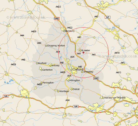
Oxfordshire Map Showing Location of Launton
Population: 1117
District: Cherwell
Easting: 460792 Northing: 220943
Latitude: 51.88 Longitude: -1.12
 = Launton
District: Cherwell
Easting: 460792 Northing: 220943
Latitude: 51.88 Longitude: -1.12
= Launton
This Launton map below is supplied by Google. Use the tools in the top left corner to zoom into street level or zoom out for a road map, you may also need to zoom in to see Launton on the map. Click and drag the map to move around. If the map fails to load try and refresh your browser or zoom in or out (+ or -).
Update - it seems Google no longer allow people to use their maps for free! This Launton map sometimes loads and sometimes gives a error. I am working on a solution.
Closest 30 Towns or Cities to Launton (Population over 500)
Launton 0km Bicester 2.95km Ambrosden 3.7km Chesterton 4.58km Caversfield 6.54km Fringford 7.42km Ardley 8.83km Kirtlington 10.46km Fritwell 10.91km Islip 10.91km Bletchingdon 10.94km Upper Heyford 11.7km Beckley 12.03km Steeple Aston 13.12km Kidlington 13.63km Tackley 13.85km Woodstock 14.22km Yarnton 15.63km Duns Tew 15.87km Wheatley 16.72km Tiddington 17.03km Oxford 17.43km Thame 17.43km Deddington 17.65km Bladon 17.65km Cuddesdon 18.56km Milton 18.67km Great Milton 18.67km Adderbury 18.88km Cassington 19.51km