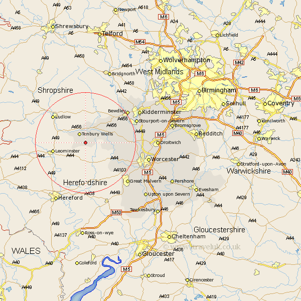
Worcestershire Map Showing Location of Great Kyre
Population: 147
District: Malvern Hills
Easting: 362470 Northing: 263357
Latitude: 52.27 Longitude: -2.55
 = Great Kyre
District: Malvern Hills
Easting: 362470 Northing: 263357
Latitude: 52.27 Longitude: -2.55
= Great Kyre
This Great Kyre map below is supplied by Google. Use the tools in the top left corner to zoom into street level or zoom out for a road map, you may also need to zoom in to see Great Kyre on the map. Click and drag the map to move around. If the map fails to load try and refresh your browser or zoom in or out (+ or -).
Update - it seems Google no longer allow people to use their maps for free! This Great Kyre map sometimes loads and sometimes gives a error. I am working on a solution.
Closest 30 Towns or Cities to Great Kyre (Population over 500)
Tenbury 4.34km Tenbury Wells 4.34km Lindridge 7.94km Clifton upon Teme 9.26km Clifton 9.26km Rock 12.6km Abberley 13.01km Martley 13.02km Great Witley 13.73km Suckley 14.36km Astley 16.3km Leigh 18.4km Bewdley 20.48km Holt 20.5km Grimley 20.76km Hallow 21.17km Stourport on Severn 21.37km Stourport 21.37km Stourport-on-Severn 21.37km Ombersley 21.55km Hartlebury 22.77km Upper Arley 22.97km Arley 22.97km Malvern 23.05km Great Malvern 23.05km Powick 23.27km Fernhill Heath 24.11km Kidderminster 24.16km Worcester 24.96km Malvern Wells 25.18km