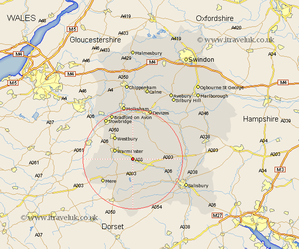
Wiltshire Map Showing Location of Knook
Population: 64
District: West Wiltshire
Easting: 394174 Northing: 140889
Latitude: 51.17 Longitude: -2.08
 = Knook
District: West Wiltshire
Easting: 394174 Northing: 140889
Latitude: 51.17 Longitude: -2.08
= Knook
This Knook map below is supplied by Google. Use the tools in the top left corner to zoom into street level or zoom out for a road map, you may also need to zoom in to see Knook on the map. Click and drag the map to move around. If the map fails to load try and refresh your browser or zoom in or out (+ or -).
Update - it seems Google no longer allow people to use their maps for free! This Knook map sometimes loads and sometimes gives a error. I am working on a solution.
Closest 30 Towns or Cities to Knook (Population over 500)
Heytesbury 2.97km Codford 2.98km Warminster 7.89km Longbridge Deverill 8.14km Hindon 8.2km West Lavington 10.93km Dilton 11km Steeple Langford 11.1km Longford 11.1km Tisbury 11.12km Edington 11.18km Bratton 11.36km Westbury 11.59km Dinton 11.61km East Knoyle 12.55km Bishop's Knoyle 12.55km Corsley 12.88km Shrewton 12.91km Erlestoke 13.02km Fovant 14.22km Lavington 14.72km Market Lavington 14.72km Mere 14.88km Steeple Ashton 15.23km Semley 15.55km North Bradley 15.95km Southwick 16.65km Worton 16.72km South Newton 16.84km Potterne 17.31km