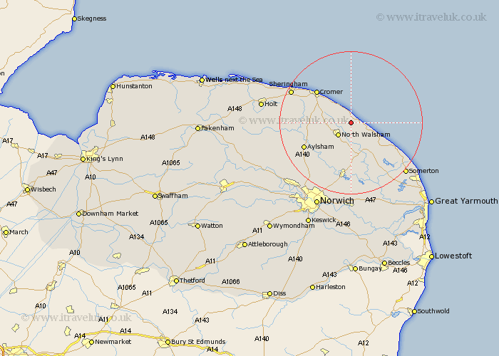
Norfolk Map Showing Location of Knapton
Population: 362
District: North Norfolk
Easting: 631150 Northing: 333614
Latitude: 52.85 Longitude: 1.43
 = Knapton
District: North Norfolk
Easting: 631150 Northing: 333614
Latitude: 52.85 Longitude: 1.43
= Knapton
This Knapton map below is supplied by Google. Use the tools in the top left corner to zoom into street level or zoom out for a road map, you may also need to zoom in to see Knapton on the map. Click and drag the map to move around. If the map fails to load try and refresh your browser or zoom in or out (+ or -).
Update - it seems Google no longer allow people to use their maps for free! This Knapton map sometimes loads and sometimes gives a error. I am working on a solution.
Closest 30 Towns or Cities to Knapton (Population over 500)
Mundersley 2.17km Mundesley 2.17km Trunch 2.24km Bacton 2.24km Walcott 4.85km North Walsham 5km Worstead 7.42km Northrepps 8.72km Felmingham 8.72km Overstrand 9.29km Smallburgh 9.33km Roughton 9.69km Happisburgh 9.69km Stalham 10.82km Erpingham 12.45km Cromer 12.88km Sutton 12.99km Lamas Little Hautbois 12.99km Lammas 12.99km Little Hautbois 12.99km Beeston Saint Lawrence 13.02km Beeston St Lawrence 13.02km Beeston St. Lawrence 13.02km Beeston 13.02km Neatishead 13.17km Coltishall 13.73km Aylsham 14.38km Catfield 14.62km Hickling 15.01km West Runton 15.4km