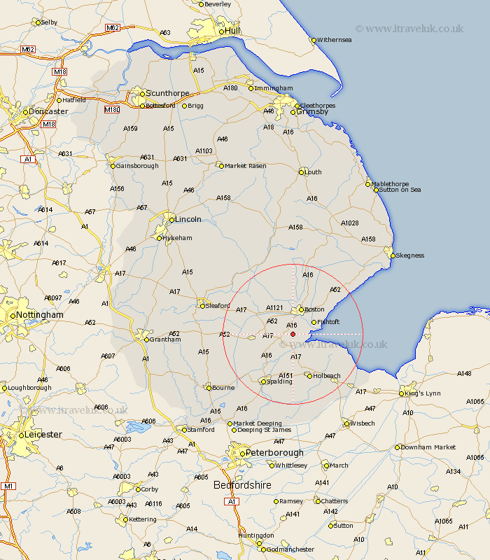
Lincolnshire Map Showing Location of Kirton
Population: 2568
Area Size (ha): 112
District: Boston
Easting: 531097 Northing: 337290
Latitude: 52.92 Longitude: -0.05
 = Kirton
Area Size (ha): 112
District: Boston
Easting: 531097 Northing: 337290
Latitude: 52.92 Longitude: -0.05
= Kirton
This Kirton map below is supplied by Google. Use the tools in the top left corner to zoom into street level or zoom out for a road map, you may also need to zoom in to see Kirton on the map. Click and drag the map to move around. If the map fails to load try and refresh your browser or zoom in or out (+ or -).
Update - it seems Google no longer allow people to use their maps for free! This Kirton map sometimes loads and sometimes gives a error. I am working on a solution.
Closest 30 Towns or Cities to Kirton (Population over 500)
Frampton 2.24km Wyberton 2.9km Sutterton 2.91km Fishtoft 6.7km Swineshead 6.95km Boston 7.73km Bicker 7.82km Brothertoft 8.13km Freiston 8.71km Frieston 8.71km Quadring 9.6km Gosberton 10km Donington 10.23km Butterwick 10.77km Surfleet 10.83km Bennington 11.6km Benington 11.6km Leverton 12.87km Frithville 13.01km Weston 13.02km Sibsey 13.71km Holbeach 13.73km Pinchbeck 14.61km Moulton 14.83km Whaplode 14.88km Old Leake 14.99km Leake 14.99km Great Hale 16.07km Hale 16.07km Heckington 16.6km