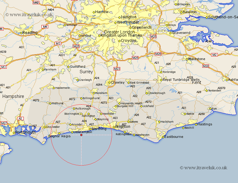
Sussex Map Showing Location of Kingston
Population: 702
District: Arun
Easting: 509255 Northing: 99399
Latitude: 50.78 Longitude: -0.45
 = Kingston
District: Arun
Easting: 509255 Northing: 99399
Latitude: 50.78 Longitude: -0.45
= Kingston
This Kingston map below is supplied by Google. Use the tools in the top left corner to zoom into street level or zoom out for a road map, you may also need to zoom in to see Kingston on the map. Click and drag the map to move around. If the map fails to load try and refresh your browser or zoom in or out (+ or -).
Update - it seems Google no longer allow people to use their maps for free! This Kingston map sometimes loads and sometimes gives a error. I am working on a solution.
Closest 30 Towns or Cities to Kingston (Population over 500)
Preston 1.17km East Preston 1.17km West Ferring 1.86km Ferring 1.86km Rustington 3.97km Angmering 4.39km Littlehampton 6.14km Worthing 7.14km Sompting 7.95km Findon 8.21km Lancing 9km North Lancing 9km Ford 10.08km Arundel 10.22km Yapton 10.71km Middleton 11.72km Middleton on Sea 11.72km Middleton-on-Sea 11.72km Barnham 13.41km Washington 13.44km Westergate 13.7km Walberton 13.86km Felpham 14.06km Bognor 14.06km Bognor Regis 14.1km Upper Bleeding 14.54km Bramber 14.54km Upper Beeding 14.54km Steyning 14.54km Slindon 14.86km