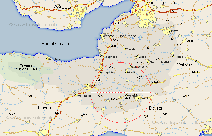
Somerset Map Showing Location of Kingsbury Episcopi
Population: 1295
District: South Somerset
Easting: 343849 Northing: 120797
Latitude: 50.98 Longitude: -2.8
 = Kingsbury Episcopi
District: South Somerset
Easting: 343849 Northing: 120797
Latitude: 50.98 Longitude: -2.8
= Kingsbury Episcopi
This Kingsbury Episcopi map below is supplied by Google. Use the tools in the top left corner to zoom into street level or zoom out for a road map, you may also need to zoom in to see Kingsbury Episcopi on the map. Click and drag the map to move around. If the map fails to load try and refresh your browser or zoom in or out (+ or -).
Update - it seems Google no longer allow people to use their maps for free! This Kingsbury Episcopi map sometimes loads and sometimes gives a error. I am working on a solution.
Closest 30 Towns or Cities to Kingsbury Episcopi (Population over 500)
South Petherton 3.7km Martock 3.96km Long Sutton 4.39km Langport 6.03km Tintinhull 6.12km Montacute 6.91km Curry Rivel 6.91km West Chinnock 8.19km Somerton 8.2km Fivehead 8.37km Ilchester 8.37km Ilton 8.97km High Ham 9.35km Yeovilton 9.51km Ilminster 9.88km Haselbury Plucknett 9.9km Stoke St Gregory 10.86km Stoke St. Gregory 10.86km Stoke Saint Gregory 10.86km West Coker 11.03km Crewkerne 11.12km North Curry 12.24km Yeovil 12.25km Othery 12.55km Mudford 12.83km Broadway 12.93km Misterton 12.97km Charlton Mackrell 13.15km Hatch Beauchamp 14km Compton 14.22km