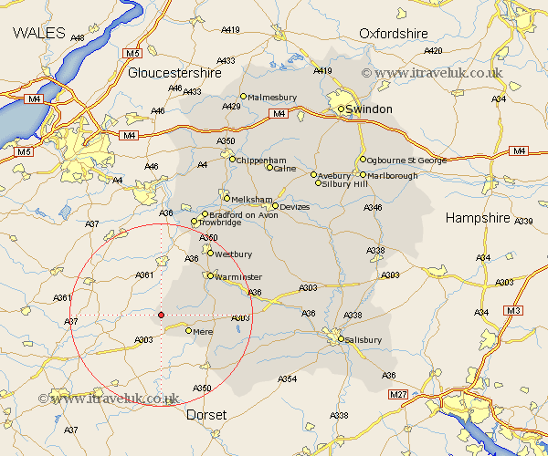
Wiltshire Map Showing Location of Kilmington
Population: 292
District: Salisbury
Easting: 376671 Northing: 135379
Latitude: 51.12 Longitude: -2.33
 = Kilmington
District: Salisbury
Easting: 376671 Northing: 135379
Latitude: 51.12 Longitude: -2.33
= Kilmington
This Kilmington map below is supplied by Google. Use the tools in the top left corner to zoom into street level or zoom out for a road map, you may also need to zoom in to see Kilmington on the map. Click and drag the map to move around. If the map fails to load try and refresh your browser or zoom in or out (+ or -).
Update - it seems Google no longer allow people to use their maps for free! This Kilmington map sometimes loads and sometimes gives a error. I am working on a solution.
Closest 30 Towns or Cities to Kilmington (Population over 500)
Zeals 2.19km Zeal 2.19km Mere 6.9km Longbridge Deverill 10.84km Corsley 12.55km East Knoyle 12.9km Bishop's Knoyle 12.9km Warminster 13.97km Hindon 14.09km Semley 15.81km Dilton 15.95km Heytesbury 16.83km Westbury 18.14km Tisbury 18.32km Southwick 19.79km Codford 20.11km North Bradley 20.23km Bratton 22.5km Westwood 22.51km Edington 23.29km Trowbridge 23.3km Limpley Stoke 24.08km Fovant 24.44km Hilperton 24.57km Steeple Ashton 24.69km Dinton 24.72km Bradford on Avon 25.81km Bradford-on-Avon 25.81km Erlestoke 26.24km Holt 27.55km