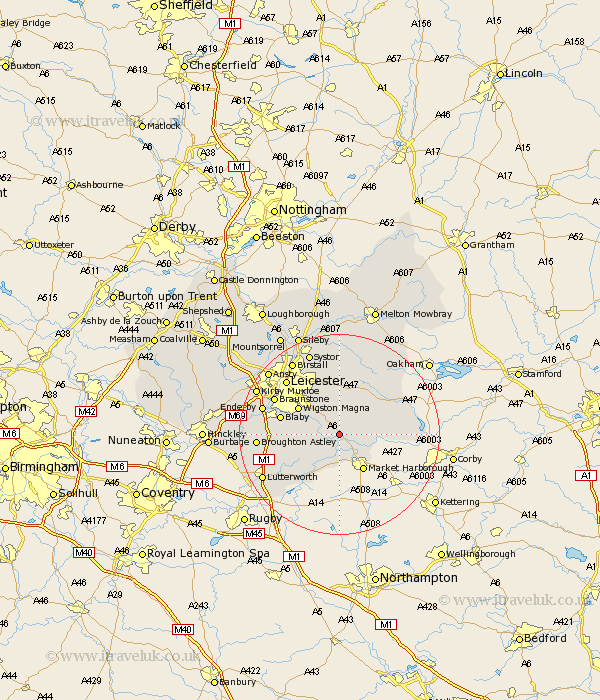
Leicestershire Map Showing Location of Kibworth Harcourt
Population: 3888
Area Size (ha): 121
District: Harborough
Easting: 468954 Northing: 293351
Latitude: 52.53 Longitude: -0.98
 = Kibworth Harcourt
Area Size (ha): 121
District: Harborough
Easting: 468954 Northing: 293351
Latitude: 52.53 Longitude: -0.98
= Kibworth Harcourt
This Kibworth Harcourt map below is supplied by Google. Use the tools in the top left corner to zoom into street level or zoom out for a road map, you may also need to zoom in to see Kibworth Harcourt on the map. Click and drag the map to move around. If the map fails to load try and refresh your browser or zoom in or out (+ or -).
Update - it seems Google no longer allow people to use their maps for free! This Kibworth Harcourt map sometimes loads and sometimes gives a error. I am working on a solution.
Closest 30 Towns or Cities to Kibworth Harcourt (Population over 500)
Great Glen 5.02km Lubenham 7.74km Bowden 7.92km Great Bowden 7.92km Billesdon 8.15km Market Harborough 8.67km Oadby 8.75km Houghton-on-the-Hill 9.27km Houghton on the Hill 9.27km Houghton 9.27km Wigston Magna 9.65km Wigston 9.65km Glen Parka 9.75km Glen Parva 9.75km Husbands Bosworth 10.3km Countesthorpe 10.31km Hallaton 10.31km Walton-in-Knaptoft 11.67km Walton 11.67km Blaby 11.86km Gilmorton 13.49km Gilmarton 13.49km Cosby 13.65km Whetstone 14.02km Braunstone 14.44km Leiscester 15.05km Leicester 15.05km Narborough 15.11km Twyford 15.5km Enderby 15.67km