Worcestershire Map Showing Location of Kempsey
Population: 3106
Area Size (ha): 75
District: Malvern Hills
Easting: 386312 Northing: 248397
Latitude: 52.13 Longitude: -2.2
 = Kempsey
Area Size (ha): 75
District: Malvern Hills
Easting: 386312 Northing: 248397
Latitude: 52.13 Longitude: -2.2
= Kempsey
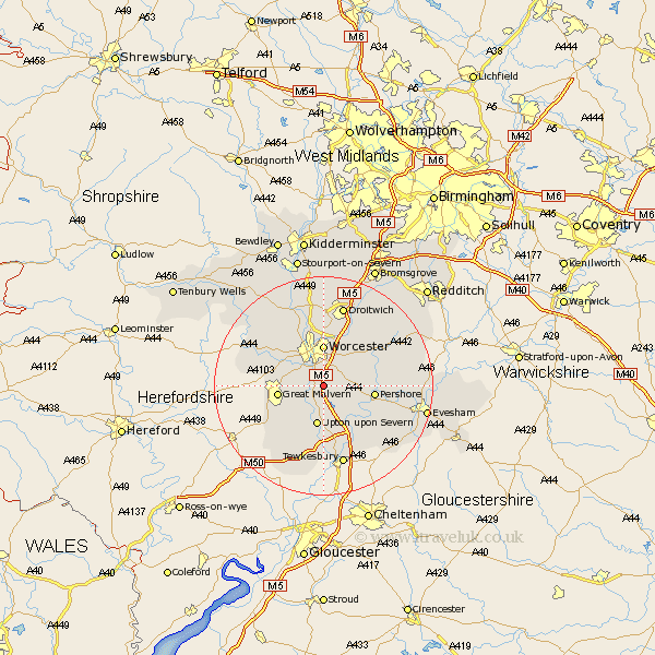
This Kempsey map below is supplied by Google. Use the tools in the top left corner to zoom into street level or zoom out for a road map, you may also need to zoom in to see Kempsey on the map. Click and drag the map to move around. If the map fails to load try and refresh your browser or zoom in or out (+ or -).
Update - it seems Google no longer allow people to use their maps for free! This Kempsey map sometimes loads and sometimes gives a error. I am working on a solution.
Closest 30 Towns or Cities to Kempsey (Population over 500)
Seven Stoke 3.87km Severn Stoke 3.87km Wadborough 3.88km Powick 5.04km Hanley Castle 6.01km Peopleton 7.07km Worcester 7.42km Upton 7.49km Upton on Severn 7.49km Upton upon Severn 7.49km Upton-on-Severn 7.49km Defford 7.96km Great Malvern 8.18km Malvern 8.18km Pershore 9.29km Eckington 9.34km Crowle 9.34km Leigh 9.71km Hallow 9.88km Malvern Wells 10.67km Fernhill Heath 11.12km Ripple 11.18km Welland 11.51km Grimley 11.63km Bredon 12.49km Fladbury 12.65km Bishampton 13.05km Castlemorton 13.05km Holt 13.42km Cropthorne 14.75km