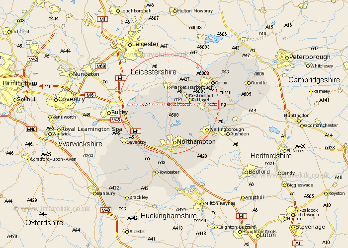
Northamptonshire Map Showing Location of Kelmarsh
Population: 80
District: Daventry
Easting: 473698 Northing: 278592
Latitude: 52.4 Longitude: -0.92
 = Kelmarsh
District: Daventry
Easting: 473698 Northing: 278592
Latitude: 52.4 Longitude: -0.92
= Kelmarsh
This Kelmarsh map below is supplied by Google. Use the tools in the top left corner to zoom into street level or zoom out for a road map, you may also need to zoom in to see Kelmarsh on the map. Click and drag the map to move around. If the map fails to load try and refresh your browser or zoom in or out (+ or -).
Update - it seems Google no longer allow people to use their maps for free! This Kelmarsh map sometimes loads and sometimes gives a error. I am working on a solution.
Closest 30 Towns or Cities to Kelmarsh (Population over 500)
Clipston 2.93km Naseby 4.89km Desborough 7.73km Rowell 8.13km Rothwell 8.13km Welford 9.23km Guilsborough 9.33km Brixworth 9.33km Spratton 9.54km Walgrave 10.05km Broughton 10.83km Pitsford 11.35km Wilbarston 12.18km West Haddon 12.6km Boughton 13.03km East Haddon 13.03km Kettering 13.57km Moulton 13.74km Yelvertoft 14.07km Cottingham 14.61km Overstone 14.65km Long Buckby 15.08km Isham 15.72km Sywell 15.82km Geddington 16.25km Crick 16.47km Northampton 16.83km Burton Latimer 17.86km Billing 18.01km Great Billing 18.01km