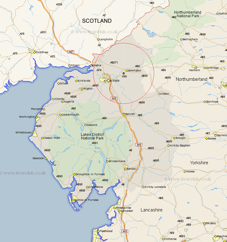
Cumbria Map Showing Location of Irthington
Population: 712
District: Carlisle
Easting: 350881 Northing: 560124
Latitude: 54.93 Longitude: -2.77
 = Irthington
District: Carlisle
Easting: 350881 Northing: 560124
Latitude: 54.93 Longitude: -2.77
= Irthington
This Irthington map below is supplied by Google. Use the tools in the top left corner to zoom into street level or zoom out for a road map, you may also need to zoom in to see Irthington on the map. Click and drag the map to move around. If the map fails to load try and refresh your browser or zoom in or out (+ or -).
Update - it seems Google no longer allow people to use their maps for free! This Irthington map sometimes loads and sometimes gives a error. I am working on a solution.
Closest 30 Towns or Cities to Irthington (Population over 500)
Brampton 2.83km Hayton 3.85km Farlam 5.64km Wetheral 8.07km Stanwix 11.28km Carlisle 12.02km Rockcliff 13.84km Rockcliffe 13.84km Longtown 14.76km Ainstable 14.97km Dalston 17.77km Burgh 18.2km Burgh by Sands 18.2km Burgh-by-Sands 18.2km Kirkoswald 19.01km Thursby 21.26km Lazonby 22.64km Lasonby 22.64km Skelton 26.72km Wigton 26.92km Hesket Newmarket 27.4km Kirkbride 28.25km Langwathby 28.53km Caldbeck 28.7km Westward 28.79km Bowness-on-Solway 28.8km Bowness on Solway 28.8km Greystoke 32.15km Culgaith 33.26km Bromfield 35.26km