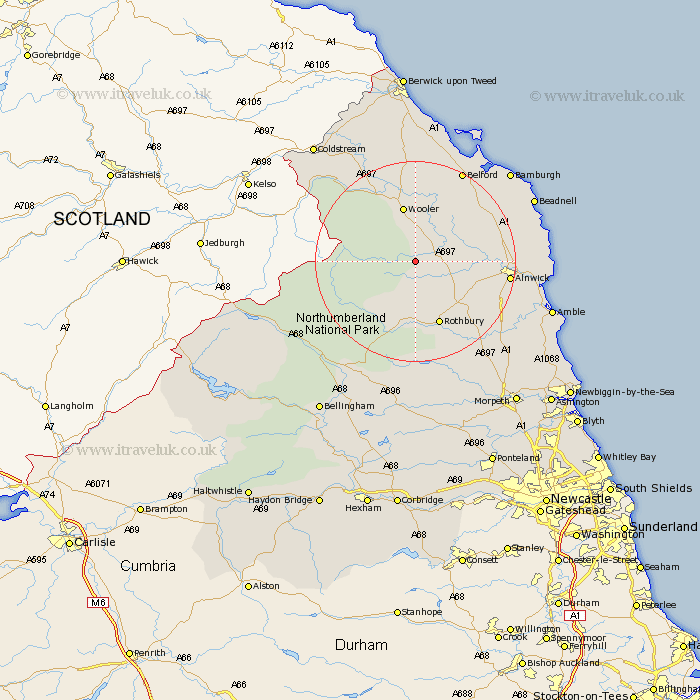
Northumberland Map Showing Location of Ingram
Population: 148
District: Berwick-upon-Tweed
Easting: 402108 Northing: 615492
Latitude: 55.43 Longitude: -1.97
 = Ingram
District: Berwick-upon-Tweed
Easting: 402108 Northing: 615492
Latitude: 55.43 Longitude: -1.97
= Ingram
This Ingram map below is supplied by Google. Use the tools in the top left corner to zoom into street level or zoom out for a road map, you may also need to zoom in to see Ingram on the map. Click and drag the map to move around. If the map fails to load try and refresh your browser or zoom in or out (+ or -).
Update - it seems Google no longer allow people to use their maps for free! This Ingram map sometimes loads and sometimes gives a error. I am working on a solution.
Closest 30 Towns or Cities to Ingram (Population over 500)
Wooler 11.32km Rothbury 13.63km Alnwick 17.23km Almwick 17.23km Shilbottle 19.36km Longframlington 20.31km Belford 20.35km Swarland 20.91km Lowick 22.24km Embleton 22.76km Lisburg 22.78km Lesbury 22.78km Alnmouth 23.44km Felton 23.71km Warkworth 23.97km North Sunderland 24.02km East Thirston 24.47km Thirston 24.47km Beadnell 24.69km Longhorsley 25.58km Amble 26.65km Otterburn 27.21km East Chevington 29.42km Ancroft 29.73km Hebron 33.08km Norham 33.55km Morpeth 34.65km Ellington 34.93km Ord 35.36km East Ord 35.36km