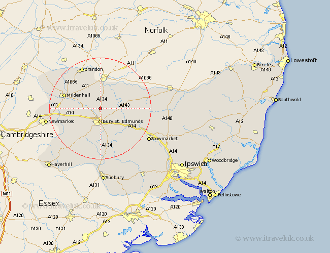
Suffolk Map Showing Location of Ingham
Population: 419
District: St. Edmundsbury
Easting: 585216 Northing: 270393
Latitude: 52.3 Longitude: 0.72
 = Ingham
District: St. Edmundsbury
Easting: 585216 Northing: 270393
Latitude: 52.3 Longitude: 0.72
= Ingham
This Ingham map below is supplied by Google. Use the tools in the top left corner to zoom into street level or zoom out for a road map, you may also need to zoom in to see Ingham on the map. Click and drag the map to move around. If the map fails to load try and refresh your browser or zoom in or out (+ or -).
Update - it seems Google no longer allow people to use their maps for free! This Ingham map sometimes loads and sometimes gives a error. I am working on a solution.
Closest 30 Towns or Cities to Ingham (Population over 500)
Fornham All Saints 3.87km Troston 4.9km Great Barton 5.03km Bury St Edmunds 5.56km Bury Saint Edmunds 5.56km Bury St. Edmunds 5.56km Honington 6.77km Risby 6.77km Barnham 7.5km Ixworth 7.93km Pakenham 8.76km Thurston 8.79km Bardwell 9.25km Rushbrooke 9.87km Norton 11.62km Barrow 11.72km Bradfield Saint George 12.48km Bradfield St. George 12.48km Bradfield 12.48km Bradfield St George 12.48km Stanton 12.6km Chevington 13.04km Barningham 13.64km Badwell Ash 13.73km Hepworth 14.09km Eriswell 14.5km Chedburgh 14.65km Mildenhall 14.69km Gazeley 14.7km Elmswell 15.5km