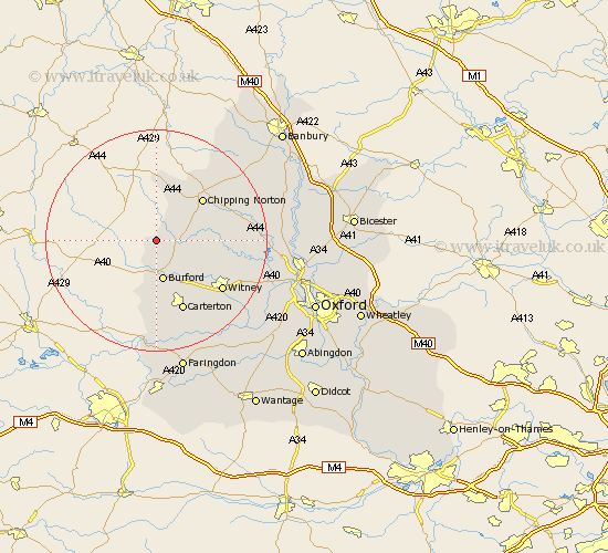
Oxfordshire Map Showing Location of Idbury
Population: 112
District: West Oxfordshire
Easting: 424096 Northing: 218787
Latitude: 51.87 Longitude: -1.65
 = Idbury
District: West Oxfordshire
Easting: 424096 Northing: 218787
Latitude: 51.87 Longitude: -1.65
= Idbury
This Idbury map below is supplied by Google. Use the tools in the top left corner to zoom into street level or zoom out for a road map, you may also need to zoom in to see Idbury on the map. Click and drag the map to move around. If the map fails to load try and refresh your browser or zoom in or out (+ or -).
Update - it seems Google no longer allow people to use their maps for free! This Idbury map sometimes loads and sometimes gives a error. I am working on a solution.
Closest 30 Towns or Cities to Idbury (Population over 500)
Kingham 4.35km Shipton under Wychwood 4.94km Shipton 4.94km Shipton-under-Wychwood 4.94km Churchill 5.89km Burford 7.5km Chadlington 9.34km Leafield 9.75km Minster Lovell 10.92km Chipping Norton 11.17km Shilton 11.64km Brize Norton 12.51km Charlbury 12.59km Barton 13.16km Hailey 13.64km Carterton 13.76km Witney 14.74km Enstone 14.81km Stonesfield 15.34km North Leigh 16.63km Hook Norton 17.28km Ducklington 17.31km Bampton 18.51km Clanfield 19.1km Hanborough 19.77km Church Handborough 19.77km Bladon 21.35km Ensham 21.44km Eynsham 21.44km Cassington 22.61km