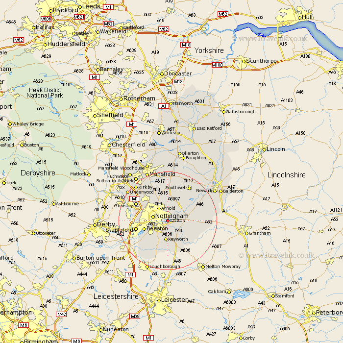
Nottinghamshire Map Showing Location of Colwick
Population: 2843
District: Gedling
Easting: 461582 Northing: 339607
Latitude: 52.95 Longitude: -1.08
 = Colwick
District: Gedling
Easting: 461582 Northing: 339607
Latitude: 52.95 Longitude: -1.08
= Colwick
This Colwick map below is supplied by Google. Use the tools in the top left corner to zoom into street level or zoom out for a road map, you may also need to zoom in to see Colwick on the map. Click and drag the map to move around. If the map fails to load try and refresh your browser or zoom in or out (+ or -).
Update - it seems Google no longer allow people to use their maps for free! This Colwick map sometimes loads and sometimes gives a error. I am working on a solution.
Closest 30 Towns or Cities to Colwick (Population over 500)
Tollerton 3.7km Radcliffe on Trent 3.83km Radcliffe 3.83km Radcliffe-on-Trent 3.83km Lambley 3.87km West Bridgeford 4.33km West Bridgford 4.33km Shelford 4.84km Burton Joyce 5km Nottingham 5.88km Nottigham 5.88km Arnold 6.49km Cotgrave 6.49km Woodborough 7.5km Cropwell 7.66km Cropwell Butler 7.66km Ruddington 8.66km Cropwell Bishop 8.71km East Bridgford 9.12km Bingham 9.13km Calverton 9.26km Claverton 9.26km Beeston 9.67km Oxton 11.18km Bunny 11.61km Flintham 12.82km Kimberley 12.83km Stapleford 12.83km Papplewick 12.98km Kinoulton 12.99km