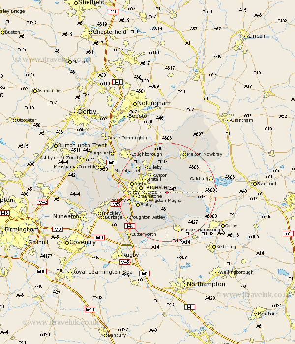
Leicestershire Map Showing Location of Houghton On The Hill
Population: 1548
District: Harborough
Easting: 468824 Northing: 302627
Latitude: 52.62 Longitude: -0.98
 = Houghton On The Hill
District: Harborough
Easting: 468824 Northing: 302627
Latitude: 52.62 Longitude: -0.98
= Houghton On The Hill
This Houghton On The Hill map below is supplied by Google. Use the tools in the top left corner to zoom into street level or zoom out for a road map, you may also need to zoom in to see Houghton On The Hill on the map. Click and drag the map to move around. If the map fails to load try and refresh your browser or zoom in or out (+ or -).
Update - it seems Google no longer allow people to use their maps for free! This Houghton On The Hill map sometimes loads and sometimes gives a error. I am working on a solution.
Closest 30 Towns or Cities to Houghton On The Hill (Population over 500)
Houghton 0km Houghton-on-the-Hill 0km Houghton on the Hill 0km Billesdon 3.85km Great Glen 6.5km Twyford 7.15km Oadby 7.71km Queniboro 8.14km Queniborough 8.14km Wigston Magna 8.71km Wigston 8.71km Kibworth 9.27km Kibworth Harcourt 9.27km Syston 9.3km Gaddesby 9.33km Leicester 10.29km Leiscester 10.29km Birstall 10.57km Glen Parka 10.59km Glen Parva 10.59km Somerby 11.55km Rearsby 11.62km Braunstone 12.52km Blaby 12.56km Hallaton 12.56km Countesthorpe 12.56km Hoby 13.01km Frisby 13.01km Frisby-on-the-Wreak 13.01km Frisby on the Wreak 13.01km