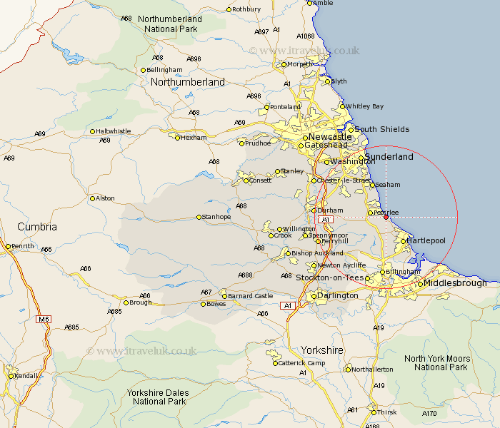
Durham Map Showing Location of Horden
Population: 8524
District: Easington
Easting: 446124 Northing: 539696
Latitude: 54.75 Longitude: -1.28
 = Horden
District: Easington
Easting: 446124 Northing: 539696
Latitude: 54.75 Longitude: -1.28
= Horden
This Horden map below is supplied by Google. Use the tools in the top left corner to zoom into street level or zoom out for a road map, you may also need to zoom in to see Horden on the map. Click and drag the map to move around. If the map fails to load try and refresh your browser or zoom in or out (+ or -).
Update - it seems Google no longer allow people to use their maps for free! This Horden map sometimes loads and sometimes gives a error. I am working on a solution.
Closest 30 Towns or Cities to Horden (Population over 500)
Hesleden 2.14km Hart 3.85km Peterlee 4.34km Hutton Henry 5.66km Easington 6.25km Shotton 6.5km Wingate 6.68km Elwick 7.42km Hartlepool 8.56km Dalton 9.14km Dalton le Dale 9.14km Haswell 9.32km South Hetton 9.32km Thornley 9.63km Trimdon 10.21km Seaham Harbour 10.26km Seaham 10.26km Seaton 11.26km Murton 11.32km Fishburn 12.16km Sherburn 12.97km Hetton le Hole 13.01km Greatham 13.37km Pittington 13.98km Coxhoe 14.4km Sedgefield 14.72km Wolviston 14.82km Bishop Middleham 14.83km Bowburn 15.09km West Rainton 15.75km